
How Do Drone Payloads Transform Industrial UAVs into Task-Oriented Platforms?
A Drone Payload system determines what an industrial UAV can sense, measure, carry, or operate during a specific task. Instead of treating the aircraft as a simple flying camera, modern UAV development increasingly combines the flight platform with application-specific equipment such as visible-light cameras, thermal imaging systems, LiDAR, agricultural distribution devices, material handling equipment, environmental sensors, lighting units, communication modules, and intelligent image-analysis hardware. Selecting an appropriate payload therefore requires attention to sensor purpose, physical size, weight, power demand, mounting method, data requirements, and the operating environment. A properly integrated payload can turn a general aircraft into a more practical platform for surveying, inspection, agriculture, infrastructure work, environmental monitoring, and other specialized applications.
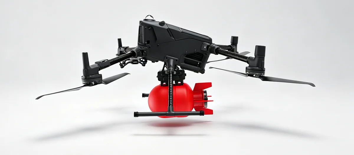
Table of Contents
Click a section to jump directly to the corresponding technical discussion.
- 1. What Determines the Role of a UAV Payload?
- 2. How Do Sensing and Mapping Systems Support Industrial Work?
- 3. When Are Visible-Light Cameras the Right Choice?
- 4. How Does Thermal Imaging Reveal Conditions That Cameras May Miss?
- 5. When Should LiDAR Be Considered for UAV Mapping?
- 6. How Can Functional Equipment Extend UAV Capabilities?
- 7. How Can UAVs Support Environmental Monitoring?
- 8. How Does Intelligent Analysis Improve Payload Use?
- 9. What Should Be Considered When Integrating Payload Equipment?
- 10. How Should Buyers Select the Right Configuration?
- 11. How Are Payload Systems Evolving for Industrial Applications?
- 12. Frequently Asked Questions
What Determines the Role of a UAV Payload?
The payload is the part of a UAV system that directly interacts with the operating task. The aircraft provides the flight platform, while the payload provides the sensing, measurement, transport, communication, or operational function required for a particular application.
This relationship is important because two aircraft with similar flight characteristics can perform completely different jobs when fitted with different equipment. A camera platform may be suitable for visual inspection, while a thermal imaging unit can provide temperature information. A LiDAR system can collect three-dimensional spatial data, while a material-handling attachment can move equipment between locations.
Payload selection therefore begins with the question of what information or physical task the aircraft needs to support. Once the task has been defined, the equipment can be selected around the required data type, accuracy, coverage, weight, power consumption, installation method, and working environment.
Sensing Collects visual, thermal, spatial, environmental, or other task-specific information from the operating area.
Operation Allows the aircraft to perform a defined physical function such as spraying, seeding, lifting, lighting, or communication.
Analysis Processes collected data to identify predefined conditions, measurements, or patterns that require further attention.
Payload selection should follow the operating objective
A useful starting point is to define the output required from the flight. If the expected result is a high-resolution image, a suitable visible-light camera may be enough. If the objective involves detecting heat differences, thermal imaging may be more appropriate. When accurate three-dimensional information is required, LiDAR may provide a more suitable data source.
The same principle applies to operational equipment. Agricultural work requires a different payload architecture from material transportation or environmental sampling. Treating all payloads as interchangeable equipment can create avoidable integration problems because each category has different mechanical and electrical requirements.
- Define the task before choosing the equipment.
- Determine the type of information or physical action required.
- Check the payload mass against aircraft capacity and propulsion requirements.
- Review payload power requirements with the aircraft electrical system.
- Consider mounting position, balance, data connections, and maintenance access.
Key principle The payload should be selected around the task. The aircraft, payload, power system, and mounting structure then need to be coordinated as one operating configuration.
How Do Sensing and Mapping Systems Support Industrial Work?
Sensing and mapping equipment provides the information layer of many industrial UAV applications. Instead of relying entirely on direct observation from the ground, operators can collect structured information from locations that are difficult, time-consuming, or inefficient to inspect manually.
Different sensors produce different forms of data. Visible-light cameras provide images and video. Thermal equipment identifies temperature patterns. LiDAR generates spatial measurements and point-cloud data. The appropriate technology depends on what needs to be observed and how the information will be used after the flight.
| Equipment Type | Primary Data | Typical Industrial Uses |
|---|---|---|
| Visible-Light Camera | High-resolution images and video | Infrastructure inspection, facility observation, agricultural monitoring, visual documentation |
| Thermal Imaging | Temperature distribution and thermal patterns | Equipment condition checks, photovoltaic inspection, electrical component assessment |
| LiDAR | Three-dimensional spatial measurements | Terrain mapping, building modeling, mine surveying, river and site measurement |
| Environmental Sensor | Gas, dust, water, or other environmental data | Environmental monitoring, industrial site assessment, field data collection |
Why different sensors cannot simply be substituted
Each sensor measures a different physical characteristic. A visible-light camera can show the appearance of a component, but it does not directly provide temperature information. A thermal camera can show an abnormal heat pattern, but it does not necessarily provide the same level of visual detail as a high-resolution camera.
LiDAR operates differently again. It measures spatial information and can produce three-dimensional representations of terrain and structures. This makes it valuable when the task depends on geometry, distance, elevation, volume, or surface structure rather than only visual appearance.
Combining multiple data sources
Some advanced applications combine several sensor types on one aircraft or across multiple flights. For example, visible imagery can provide visual context while thermal information highlights temperature anomalies. Spatial data can then add accurate geometric information to the same inspection workflow.
Such combinations can improve the completeness of collected information, but they also create additional integration requirements. The aircraft needs sufficient payload capacity, power, mounting space, communication interfaces, and flight stability for the combined equipment.
When Are Visible-Light Cameras the Right Choice?
Visible-light cameras remain one of the most widely applicable payload types because many industrial tasks begin with visual information. High-resolution images and video can document the condition of structures, machinery, agricultural areas, buildings, and other physical environments.
For infrastructure work, detailed images can help operators inspect visible surface conditions from a different angle or distance. Industrial facilities can use aerial imaging to observe external structures, roof areas, equipment locations, or other areas that may not be convenient to examine continuously from the ground.
Resolution should be matched to the task
A higher-resolution camera can capture more visual detail, but resolution should be considered alongside flight altitude, field of view, movement, lighting, storage requirements, and the actual inspection objective.
For example, a broad-area agricultural observation task may prioritize coverage and consistent image acquisition, while a detailed structural inspection may require greater image detail from a closer operating distance.
Video and still images serve different purposes
Video can provide continuous visual information during flight and may be useful for dynamic inspection workflows or live observation. Still images can provide high-detail records for later analysis, measurement, comparison, or documentation.
The appropriate imaging mode depends on the task. Some applications can benefit from both, especially when operators need live situational information while also requiring detailed records for later review.
- Infrastructure: Supports visual checks of external surfaces and structural conditions.
- Industrial facilities: Provides aerial views of roofs, equipment areas, and difficult-to-access locations.
- Agriculture: Supports crop observation and visual assessment of field conditions.
- General documentation: Creates repeatable visual records of defined areas or assets.
Mounting stability also affects image quality
A high-quality camera cannot compensate completely for an unstable installation. Vibration from motors and rotating components can affect the quality of collected images, especially when the task requires fine visual detail.
Camera mounting, aircraft structure, vibration control, flight behavior, and operating speed should therefore be considered together. A payload is only useful when the collected data is sufficiently clear for the intended analysis.
How Does Thermal Imaging Reveal Conditions That Cameras May Miss?
Thermal imaging provides a different type of information from conventional visual photography. Instead of relying primarily on visible light, thermal sensors detect variations in infrared radiation associated with surface temperature.
This can make thermal equipment useful when the condition of an asset is related to heat distribution. An electrical component operating abnormally may produce a localized temperature increase. A photovoltaic installation can show temperature differences across modules. Industrial equipment can also produce thermal patterns that provide additional information during inspection.
Thermal data adds another layer of inspection
Visual and thermal information can complement one another. A visible image can show the physical appearance of a component, while a thermal image can show whether part of that component has a different temperature pattern.
This makes thermal equipment particularly useful when the issue cannot be identified reliably through appearance alone. However, thermal readings still need to be interpreted according to the equipment, environment, surface characteristics, and measurement conditions.
Power infrastructure
Thermal imaging can help identify temperature differences in electrical components and other equipment where abnormal heat may require further inspection.
Photovoltaic systems
Temperature patterns across solar modules can provide additional information during aerial inspection workflows.
Industrial machinery
Thermal images can supplement visual inspection when equipment condition is associated with abnormal heat generation.
Combined inspection
Visible and thermal sensors can be used together when both physical appearance and temperature behavior need to be evaluated.
Environmental conditions still matter
Thermal imaging does not operate independently from the surrounding environment. Weather, surface properties, measurement distance, and heat exchange can influence what the sensor observes.
For this reason, thermal inspection should have clearly defined operating conditions and interpretation methods. The payload provides the data, while the inspection workflow determines how that data should be evaluated.
When Should LiDAR Be Considered for UAV Mapping?
LiDAR becomes valuable when the task depends on accurate spatial information rather than visual appearance alone. It can collect distance measurements and generate point-cloud data that supports three-dimensional representations of terrain, structures, and other environments.
This makes LiDAR suitable for applications such as mine surveying, building modeling, terrain mapping, construction measurement, and river or site surveys.
Three-dimensional information changes the workflow
Traditional photographs provide two-dimensional image information. LiDAR adds depth and distance measurements, allowing software to reconstruct spatial relationships within the surveyed area.
For a building, this can help create a three-dimensional model. For terrain, it can provide elevation information. For a mine or industrial site, it can support measurements of surfaces, slopes, and spatial relationships.
| Task | Useful Spatial Output | Potential Application |
|---|---|---|
| Terrain Survey | Elevation and surface information | Site mapping, terrain analysis, route planning |
| Building Modeling | Three-dimensional structure data | Digital modeling and dimensional analysis |
| Mine Mapping | Surface geometry and spatial measurements | Surveying and site documentation |
| River Survey | Spatial and terrain information around waterways | Site measurement and environmental assessment |
LiDAR requires suitable flight planning
Data quality depends not only on the sensor itself but also on flight path, operating altitude, aircraft stability, environmental conditions, and data-processing methods.
The aircraft needs to maintain a suitable flight condition so that the sensor can collect consistent spatial measurements. The resulting data then needs to be processed into the format required by the project, such as point clouds, terrain models, or three-dimensional structures.
When these elements are coordinated, LiDAR can provide a more detailed spatial view of areas where manual measurement would be difficult or inefficient.
How Can Functional Equipment Extend UAV Capabilities?
Not every payload is designed to collect information. Some are designed to perform a physical operation or support a defined workflow on the ground.
Agricultural distribution equipment, material lifting systems, lighting modules, and communication equipment are examples of functional payload categories. They change the role of the UAV from an observation platform into a task-oriented aerial tool.
Agricultural spraying and seeding
Agricultural equipment can include precision spraying systems, material distribution boxes, and seeding devices. These systems are designed around controlled distribution rather than simple transportation of a container.
The aircraft needs to account for the payload mass, liquid or material volume, distribution mechanism, power requirements, and operating pattern. Uniform application depends on both the payload mechanism and the way the aircraft is operated.
Material lifting and transportation
Material-handling equipment can allow an aircraft to move lightweight tools, components, or maintenance materials to locations that may be difficult to reach directly from the ground.
The mechanical structure needs to support the intended load while keeping the aircraft balanced. Load location, attachment points, structural strength, and release or handling mechanisms all need to be considered when developing the configuration.
Lighting and communication equipment
High-intensity lighting can support nighttime inspection, maintenance, and other low-light operating conditions. Communication equipment can provide real-time voice transmission when operators need to communicate with people located away from the normal control position.
These payloads demonstrate why the aircraft should be considered as a complete system. Lighting adds electrical demand. Communication equipment adds electrical and data requirements. Lifting equipment changes the structural load. Agricultural equipment affects aircraft mass throughout operation.
Spraying & Seeding Combines controlled material distribution with an aircraft platform suitable for agricultural operations.
Material Handling Uses dedicated structures to support transport of lightweight tools and materials to selected locations.
Lighting & Communication Adds illumination or voice communication functions for specific inspection, maintenance, and operational workflows.
Functional payloads require more than mounting space
A payload that performs a physical function can create dynamic loads during operation. A spraying device changes its mass as material is consumed. A lifting attachment changes the aircraft's load when an object is picked up or released.
These changes mean that developers need to evaluate the operating sequence rather than only the static payload weight. Mechanical structure, propulsion capability, control response, battery capacity, and center of gravity may all be affected.
How Can UAVs Support Environmental Monitoring?
Environmental payloads allow aircraft to collect information from industrial sites, waterways, agricultural areas, and other locations where distributed measurement is required.
Depending on the equipment, a UAV can carry gas-detection sensors, dust-monitoring devices, water-sampling equipment, or other specialized sensors. The aircraft provides mobility, while the payload provides the measurement function.
Gas and air-quality monitoring
Gas detection equipment can collect information at selected positions around industrial facilities or other areas where air conditions need to be evaluated. Aerial mobility can help operators inspect multiple locations without physically entering every area.
For reliable monitoring, the sensor needs to be operated according to its specified measurement conditions. Altitude, airflow, sensor response, sampling method, and flight path can influence the collected data.
Water-quality sampling
Water sampling equipment can be used where samples or measurements need to be collected from selected positions along rivers, reservoirs, or other water bodies. The aircraft can reach locations that may be inconvenient to access directly from the shore.
The payload design needs to consider the sampling method, container capacity, attachment structure, and interaction between the aircraft and the water environment.
Dust and particulate monitoring
Airborne measurement equipment can also support monitoring of dust or other particulate conditions. The objective is not simply to collect a reading but to create a repeatable measurement process across defined locations and operating conditions.
- Define the environmental parameter to be measured.
- Select a sensor that matches the required measurement range and application.
- Plan flight paths and sampling positions around the monitoring objective.
- Consider weather, airflow, temperature, and other environmental variables.
- Define how collected data will be stored, processed, and interpreted.
Data quality matters A sensor can only produce useful information when its operating conditions, installation, sampling method, and data-processing workflow are properly coordinated.
How Does Intelligent Analysis Improve Payload Use?
Collecting data is only one part of an inspection workflow. As image and sensor datasets become larger, automated analysis can help operators identify predefined conditions more efficiently.
AI-based image-analysis modules can be used with suitable cameras to identify conditions such as surface cracks, visible line damage, equipment anomalies, or predefined visual irregularities. The objective is to transform raw image data into information that can support inspection decisions.
From image collection to condition recognition
In a conventional inspection workflow, a flight may generate a large number of images that later need to be reviewed manually. An intelligent analysis module can process the collected images and flag areas that match predefined recognition criteria.
This does not eliminate the need for human review. Instead, it can help organize large amounts of inspection data and direct attention toward images or locations that require closer examination.
Real-time and post-flight analysis
Depending on system architecture, analysis can take place during flight or after data collection. Real-time processing can provide faster information when immediate decisions are required. Post-flight processing can support more detailed analysis using larger datasets and additional computing resources.
Data collection
The sensor captures images or measurements according to the flight plan and task requirements.
Data screening
The system processes collected information and identifies predefined patterns or conditions.
Result organization
Potential issues can be grouped by location, equipment, image, or other project-defined criteria.
Human verification
Operators can review flagged information and determine whether additional inspection is required.
Integration determines practical usefulness
An intelligent module needs access to suitable image data, adequate computing resources, compatible interfaces, and appropriate mounting. The aircraft also needs to maintain a flight condition that allows the sensor to collect useful information.
As a result, AI functionality should not be considered separately from the camera, aircraft, data link, power system, and processing workflow. The practical value comes from how these parts work together.
What Should Be Considered When Integrating Payload Equipment?
Payload integration begins with mechanical compatibility but extends into electrical, structural, control, thermal, and data considerations. A payload may work correctly on a laboratory bench and still require changes before it can operate reliably on an aircraft.
Weight and center of gravity
Payload mass contributes directly to the aircraft's total operating weight. More importantly, the location of that mass affects the aircraft's center of gravity.
A payload mounted far from the aircraft's center can produce a different effect from one mounted close to it, even when the two payloads have the same mass. Mounting position should therefore be considered during structural design.
Power requirements
Some payloads have relatively low electrical demand, while others may require substantial power. Lighting systems, powered mechanisms, computing modules, and certain sensors can all add to the aircraft's electrical load.
The aircraft battery and power distribution system need to account for this additional requirement. Otherwise, the payload may affect the operating behavior of the complete platform.
Mounting and vibration
The mounting structure must keep the payload secure while limiting unnecessary movement. For cameras and other precision sensors, vibration can affect data quality. For functional equipment, structural movement can affect the accuracy of the physical operation.
Data and communication interfaces
Modern payloads may generate large image files, live video, sensor measurements, or other structured information. The communication architecture therefore needs to support the required data flow between the payload, aircraft, ground equipment, or onboard processing system.
| Integration Area | Key Question | Potential Impact |
|---|---|---|
| Weight | Can the aircraft support the complete payload mass? | Affects total aircraft load and propulsion demand |
| Center of Gravity | Where is the payload positioned? | Can influence aircraft balance and flight behavior |
| Power | How much electrical power does the equipment require? | Changes the overall electrical load and battery requirements |
| Mounting | How is the equipment attached and stabilized? | Influences structural integrity, vibration, and data quality |
| Data Interface | How is information transmitted or stored? | Determines communication and processing requirements |
| Maintenance | Can the equipment be accessed and replaced efficiently? | Affects serviceability and operational convenience |
Integration should be reviewed before production
It is usually easier to solve interface problems before the aircraft structure and payload mounting system are finalized. Drawings, equipment dimensions, connector locations, power specifications, mounting points, and operating requirements provide a useful technical basis.
When these details are defined early, structural parts and electrical interfaces can be developed around the equipment rather than modified repeatedly later.
How Should Buyers Select the Right Configuration?
Payload selection should be based on the actual task and the complete UAV configuration. A technically advanced sensor can still be unsuitable if it is too heavy, consumes too much power, cannot be mounted properly, or produces data that does not match the intended workflow.
Start with the output
Define what the operator needs after the flight. Is the objective a high-resolution image, a temperature map, a three-dimensional model, an environmental measurement, a physical operation, or a combination of several outputs?
This question narrows the equipment category before more detailed specifications are considered.
Review the aircraft limits
Check maximum payload mass, mounting space, available power, aircraft dimensions, flight behavior, and any restrictions imposed by the existing structure.
Consider the operating environment
Temperature, dust, humidity, vibration, wind, lighting, terrain, and operating altitude can all influence equipment performance. The payload should be suitable for the conditions in which it will actually be used.
Evaluate the data workflow
Sensor selection should include the complete information chain. Consider how data will be captured, stored, transmitted, processed, reviewed, and archived.
- Task: What physical operation or information is required?
- Mass: What is the complete weight of the equipment and accessories?
- Power: What electrical input is required during normal operation?
- Dimensions: What mounting space is available on the aircraft?
- Environment: What temperature, vibration, lighting, and weather conditions are expected?
- Data: What information must be collected and how will it be processed?
| Selection Factor | What to Define | Why It Matters |
|---|---|---|
| Application | Inspection, mapping, agriculture, monitoring, transportation, or another task | Determines the basic payload category |
| Payload Mass | Total equipment and mounting weight | Must match aircraft and propulsion capability |
| Power | Voltage and expected electrical demand | Must be compatible with the UAV power system |
| Mounting | Physical interface and equipment position | Affects structure, stability, and maintenance |
| Data Output | Images, thermal information, point clouds, sensor readings, or operational results | Determines the downstream processing workflow |
How Are Payload Systems Evolving for Industrial Applications?
The development of UAV payload technology is increasingly focused on four practical directions: smaller equipment, greater sensing precision, more intelligent data processing, and closer integration with the aircraft.
Miniaturization can allow useful equipment to be installed on smaller aircraft or allow multiple devices to be combined on one platform. Reduced size can also simplify mechanical integration when installation space is limited.
Higher sensing precision
Industrial tasks often require more than general visual information. Detailed inspection, temperature analysis, three-dimensional measurement, and environmental monitoring all depend on sensors that can produce data appropriate for the target task.
Higher precision is therefore not an isolated specification. It needs to be connected to the required measurement method, operating distance, aircraft stability, and data-processing workflow.
Greater intelligence
As sensors generate more information, automated analysis becomes increasingly useful. AI-based recognition can help identify predefined patterns in large image sets, organize inspection data, and highlight areas that deserve additional review.
This development changes the role of the payload from a passive data collector to an active part of the information workflow.
Deeper system integration
The next stage of development is not simply adding more equipment. It is integrating the aircraft, payload, propulsion, battery, structure, communication interfaces, and processing systems so that they operate as one coordinated platform.
This is particularly important for customized industrial applications. A specialized payload can influence battery requirements. Battery changes can influence aircraft mass. Structural changes can affect payload mounting. Additional computing can alter power demand. System-level design helps keep these relationships aligned.
Miniaturization Smaller equipment can simplify installation and create more flexibility for compact aircraft platforms.
Higher Precision Improved sensors can provide more detailed visual, thermal, spatial, or environmental information.
Intelligent Processing Automated analysis can help convert large volumes of collected data into prioritized inspection information.
Industrial UAVs are becoming more application-specific
The value of a professional aircraft increasingly depends on how well it fits the task for which it is deployed. A platform designed around inspection requirements may have different structural and electrical priorities from one designed for agriculture or material handling.
This means payload development and aircraft development are becoming increasingly connected. Instead of selecting a generic aircraft first and adding equipment afterward, project teams can define the operating task and develop the complete system around it.
System perspective Future development is likely to focus less on the aircraft as an isolated flying machine and more on the relationship between the aircraft, payload, power system, data processing, and specific industrial workflow.
Frequently Asked Questions
What types of payload equipment can be used with industrial UAVs?
Common categories include visible-light cameras, thermal imaging systems, LiDAR, agricultural spraying and seeding equipment, material-handling devices, environmental sensors, lighting systems, communication modules, and intelligent image-analysis equipment. The appropriate choice depends on the operating task.
How do I choose between a visible-light camera and thermal imaging?
A visible-light camera is suitable when the task depends mainly on surface appearance, images, or video. Thermal imaging is useful when temperature differences or heat patterns are important. Some inspection workflows can use both to obtain complementary information.
When should LiDAR be used instead of a conventional camera?
LiDAR should be considered when the project requires three-dimensional spatial measurements, terrain information, elevation data, or structural modeling. A conventional camera provides visual information, while LiDAR adds distance and spatial measurement capabilities.
Can one UAV carry multiple payload systems?
It can be possible when the aircraft has sufficient payload capacity, physical installation space, available power, appropriate structural support, and compatible data interfaces. Multiple payloads should be evaluated together because their combined weight and power demand affect the aircraft configuration.
What factors affect payload integration?
Important factors include payload weight, dimensions, center of gravity, mounting method, power requirements, vibration, data interfaces, environmental conditions, and maintenance access. These characteristics should be reviewed before the final aircraft configuration is confirmed.
Can payload equipment be customized for a specific UAV?
Project-specific configurations can be developed around defined equipment dimensions, mounting requirements, power characteristics, and operating conditions. The degree of customization depends on the application and the technical parameters required by the aircraft.
How can intelligent image analysis be used with UAV equipment?
Suitable AI-based modules can analyze collected images and identify predefined conditions such as surface cracks, visible line damage, equipment anomalies, or other specified patterns. The results can help organize large datasets and direct attention toward areas requiring further review.
Are payload systems suitable for agricultural applications?
Yes. Agricultural equipment can include spraying and seeding systems designed for controlled material distribution. The payload configuration should match the aircraft's operating load, available power, tank or material capacity, and application requirements.
Can UAV payloads support environmental monitoring?
Yes. UAVs can carry equipment for gas detection, dust monitoring, water sampling, and other environmental measurements. The sensor, flight path, sampling method, and environmental conditions should all be considered when developing the monitoring workflow.
What should be defined before discussing a customized payload solution?
Useful information includes the intended task, payload dimensions, total weight, required power, mounting interface, data requirements, operating environment, expected flight conditions, and any specific measurement or operational requirements.
Plan a Payload Configuration for Your UAV
Share the intended application, equipment dimensions, payload weight, power requirements, mounting conditions, or sensing objectives to start a focused technical discussion.
contact us to discuss your payload requirements